

Maghera [An Machaire]
Good walks are even better shared.
Overview
Maghera [An Machaire]
Overview
Situated in the stunning Caha Mountains, Maghera, or An Machaire as it’s known in Irish, stands at an impressive elevation of 550 meters. Known as a Marilyn, it offers a rewarding hiking experience for those seeking to pair exercise with breathtaking views.
Geology
Maghera is a glorious display of granite and schist, surviving the ravages of time thanks to the tireless grind of glaciers. The mountain’s rocky face offers not just a challenge to climbers but a textbook of geological history for enthusiasts curious about the Earth’s formation.
Routes
Maghera via Caha Pass
This moderate route spans approximately 5.5 km, typically taking around 2.5 hours to conquer. Starting from the Caha Pass, hikers are treated to lush greenery and rocky outcrops along the way. This is not just a hike; it’s an adventure through nature’s playground. Don’t forget the camera!
Summit Features
Upon reaching the summit, you’ll encounter a well-constructed cairn—a perfect spot to sit down and take in the view. The peaks and valleys lay spread out before you like a patchwork quilt, with knitting needles fashioned from rock and glen!
Terrain Type
Expect a rocky ascent peppered with grass and some boggy patches—perfect for testing your footing and your sense of humour. Proper hiking boots are recommended to navigate the terrain safely.
Views
The vistas from Maghera are nothing short of spectacular. On a clear day, you’ll be able to spot Bantry Bay and the Beara Peninsula, not to mention the distant peaks of County Kerry. Seasons of spring and autumn are particularly magnificent for witnessing nature in its full glory.
Hazards
While Maghera is generally accessible, be mindful of steep drop-offs at the summit, sudden weather changes, and loose rocks that may conspire against your footing. Always check local weather forecasts before setting out.
Nearby Summits
Hikers may also consider exploring Knockboy (706 meters) and Garnish Hill (590 meters) for additional adventures on their trip.
Access
Parking is plentiful at Caha Pass, which is conveniently located off the R572. While public transport is limited, the nearest bus stop in Glengarriff is only a short trek away. Bantry, the nearest town, offers all the amenities a tired hiker needs, from cafes to comfortable beds.
Facilities
After your exhilarating hike, rest your weary legs in one of the charming cafes in Bantry or Glengarriff, where you can find public toilets to freshen up.
History
The name Maghera, meaning 'the plain,' is a nod to the broad lush valleys surrounding it. The mountain is steeped in local folklore, giving it a sense of cultural significance that adds to its allure.
Conclusion
In short, Maghera [An Machaire] is a multifaceted outdoor experience waiting just for you. Whether you climb for the views, the fresh air, or just to justify that extra slice of cake post-hike, this mountain delivers on all fronts. Lace up those boots and let the adventure begin!
Explore routes near Maghera [An Machaire]
Public walks starting within 80 km of this hill. Nearby does not mean a route reaches the summit; check its map and access before setting out.
No public routes are currently listed within 80 km of Maghera [An Machaire] on Walkmates. This does not mean there are no paths here. Explore the map and check local access information before planning a walk.
Route planning notes
These notes describe possible approaches, not verified navigable routes or permission to cross land. Check current paths, local access rules and conditions before setting out.
Maghera via Caha Pass
This route offers a scenic ascent through lush green valleys and rocky outcrops, making it a favourite for both new and seasoned hikers.
Make a day of it, together
Find someone to share the walk with, or organise a day out along a route you like.
Photo Gallery
View all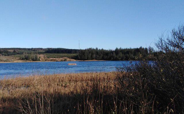 Photo could not load
R5191 : Maghera Mountain Mast view from Lough Mahera
colm
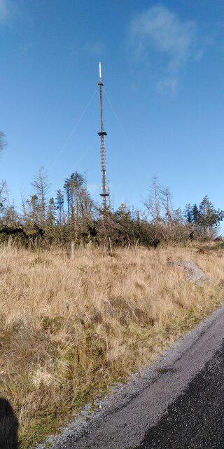 Photo could not load
R5191 : Maghera Mountain TV Transmitter
colm
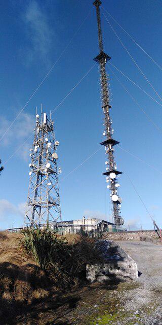 Photo could not load
R5191 : Maghera Mountain TV Transmitter (closer)
colm
Hill facts and local notes
Classifications
Elevation
400m
1,312 ft
Prominence
332m
Coordinates
52.9686, -8.7188
R517910
OS Map
52
At the Summit
The summit features a prominent cairn and offers a breathtaking view of the surrounding landscape, including a glimpse of the nearby glens and valleys.
Terrain & Geology
The Caha Mountains, including Maghera, are primarily composed of granite and schist, which can be seen in the rugged outcrops along the slopes. The area's geological history is marked by significant glacial erosion, resulting in distinctive U-shaped valleys.
Views & Scenery
From the summit, you can see the beautiful Bantry Bay, the Beara Peninsula, and on a clear day, even the distant peaks of the Kerry mountains. It's a smorgasbord for the eyes!
History & Heritage
Name Origin
The name 'Maghera' is derived from the Irish 'An Machaire,' meaning 'the plain'—presumably a nod to the broad valleys surrounding the mountain.
Historical Significance
Maghera holds cultural importance as part of the rugged landscape that has shaped local folklore and traditions.
Getting There & Facilities
Check current local access restrictions, parking rules and transport timetables before travelling. These notes do not confirm public access to the summit.
Parking
There is ample free parking at the Caha Pass where the trail begins, just off the R572 road.
Public Transport
Limited public transport options; the nearest bus stop is in the village of Glengarriff, approximately 10 km away.
Nearby Facilities
Cafes and public toilets are available in Bantry and Glengarriff, providing a welcome rest after your adventures.
Safety Information
Known Hazards
- Potential for steep drop-offs at the summit, changing weather conditions, and loose rocks in some areas.
General Safety Tips
- Check weather conditions before setting out
- Carry appropriate clothing and equipment
- Let someone know your planned route
- Take a map, compass, and GPS device
- Carry emergency supplies: food, water, first aid kit, torch
Hills
Some common questions about the hills answered
Are there group walks up Maghera [An Machaire]?
Many walkers use Walkmates to join or organise walks with others. You can check for group walks around Maghera [An Machaire] through the maps
Are there other walkers around Maghera [An Machaire]?
Activity varies by location and time, but Walkmates lets you see whether others have shared walks or shown interest in this area. Find other people through the walking friends search walking friends for Maghera [An Machaire] search or of course create your own walk for Maghera [An Machaire]
Can I organise a walk to Maghera [An Machaire]?
Yes. If there aren’t any walks listed already, you can create a walk and make it available for others to join.
If you're signed up to Walkmates, you can create a walk to Maghera [An Machaire].
How do I find a walk up this hill?
There are often multiple ways to walk this hill, depending on experience and route preference. Walkmates helps you explore walks and routes that others have shared.
Can I suggest a new route up Maghera [An Machaire]?
Yes. You can suggest or create routes to share with others. Walkmates focuses on the social side of walking, so routes are used to help people organise walks and explore areas together, rather than as detailed navigation tools or route libraries.
Other uses really appreciate knowledgeable walkers sharing their routes. Share your favourite route to Maghera [An Machaire] here
The is an error or something incorrect about this hill. How do I let you know?
We always strive to keep the information on Walkmates as accurate as possible. If you find an error, please let us know through the contact form and we'll aim to correct it as quickly as possible
Community Discussion
Comments
Location
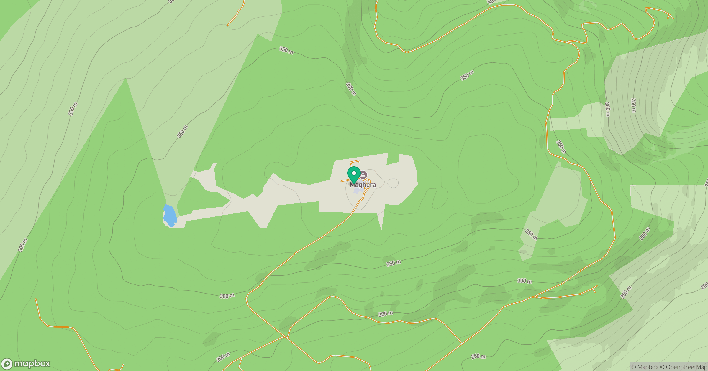
Grid reference: R517910
View on OpenStreetMapOpens a map in a new tab, centred on the hill.
Hills within 30 km
Straight-line distance, not a walking route or confirmation of access.
No comments yet. Be the first.